


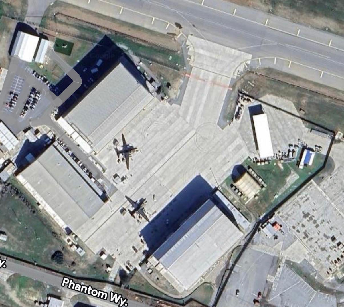
Insurgent group Hezbollah used Google Maps to plan the drone strike which it carried out on Cyprus’ British Akrotiri air force base , according to reports on Monday.
British newspaper The Times quoted a “military source” as having said that last week’s drone strike was concerning “because they were hitting what they were aiming at”, with Google Maps’ satellite imagery showing an American Lockheed U-2 reconnaissance aircraft parked outside the


